Search
Now showing items 1-10 of 14
Effect of inorganic salts and matrix crosslinking on the dose response of polymer gel dosimeters based on acrylamide
(Elsevier Ltd, 2018-07-17)
The use of additives in polymer gel dosimeters to enhance their sensitivity or to improve their performance is of
great importance for their application in radiomedicine. Inorganic salts have been used as additives with ...
Modeling the Tsunami Potential along the Pacific Coast of Central America
(2018)
Along the Pacific of Central America the Cocos plate subducts beneath the Caribbean plate, at the Middle America Trench (MAT). There are no records of mega earthquakes originated there; probably associated to the low ...

Tsunami Threat Assessment for the North and Central Pacific Coast of Costa Rica
(Seismological Research Letters, 2018)
A joint international conference of the Seismological Society of America (SSA) and the Latin American and Caribbean Seismological Commission (LACSC) will be held in Miami, Florida on 14 – 17 May 2018. The conference is the ...
The 2017 México Tsunami Record, Numerical Modeling and Threat Assessment in Costa Rica
(Springer, 2018-03-30)
An Mw 8.2 earthquake and tsunami occurred off- shore the Pacific coast of Me´xico on 2017-09-08, at 04:49 UTC. Costa Rican tide gauges have registered a total of 21 local, regional and far-field tsunamis. The Quepos gauge ...
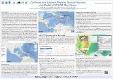
Caribbean and Adjacent Regions Tsunami Sources and Models (CATSAM) Map Viewer
(2018)
Since 2011, UNESCO - Intergovernmental Oceanographic Commission (IOC) Experts Meetings and CaribeWave exercises have resulted in a variety of tsunami models of credible scenarios that would impact the Caribbean and adjacent ...
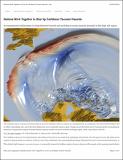
Nations work together to size up Caribbean tsunami hazards
(AGU.ORG, 2018-10-04)
El Caribe es conocido por sus playas tropicales y centros de surf, pero no está exento de terremotos y tsunamis. Durante los últimos 500 años, esta región puede haber estado expuesta a aproximadamente 100 tsunamis, de los ...
Análisis de Registros de Tsunamis anteriores a 1969 observados en la estación de Puntarenas
(IV Congreso Nacional de Gestión del Riesgo y Adaptación al Cambio Climático, Heredia, 10 y 11 de octubre 2018, 2018)
Los mareógrafos de Puntarenas, Quepos y Limón fueron instalados en la década de 1940 como una colaboración entre el Instituto Geográfico Nacional (IGN) y la Agencia Nacional Atmosférica y Oceanográfica de los Estados Unidos ...

Gestionando el riesgo por tsunami desde las comunidades
(IV Congreso Nacional de Gestión del Riesgo y Adaptación al Cambio Climático, Heredia 10 y 11 de octubre 2018, 2018)
En caso de que la Comisión Nacional de Prevención de Riesgos y Atención de Emergencias (CNE) declare alerta por tsunami, las personas que se encuentran zonas de riesgo deben evacuar antes de la llegada de la primera ola. ...
Estructura del fitoplancton en las épocas seca y lluviosa en el golfo de Papagayo, Costa Rica
(Universidad Nacional (Costa Rica), 2018-07)
Con el propósito de estudiar la estructura de la comunidad fitoplanctónica en el golfo de Papagayo, se realizaron 2 muestreos en febrero y junio del 2017, y se analizó adicionalmente información hidrográfica. Su composición ...
Coastal currents in the Eastern Gulf of Tehuantepec from coastal altimetry
(Advances in Space Research, 2018-06-02)
we study the seasonal and interannual variability of the coastal currents along the eastern shelf of the Gulf of Tehuantepec. We use sea level from coastal altimetry distributed by the Centre de Topographie des Oceans et ...