Search
Now showing items 21-30 of 31
Seismogenic zone structure along the Middle America Trench, Nicoya Peninsula, Costa Rica, from 3D local earthquake tomography
(American Geophysical Union, 2004)
Resumen de la ponencia "Estructura de la zona sismogénica a lo largo de la Fosa Mesoamericana, Nicoya Península, Costa Rica, a partir de tomografía sísmica local 3D"
Coastal Deformation Patterns Along the Nicoya Seismic Gap, Pacific Coast, Costa Rica, Central America
(American Geophysical Union, 2004)
Summary of the paper "Coastal Deformation Patterns Along the Nicoya Seismic Gap, Pacific
Coast, Costa Rica, Central America"
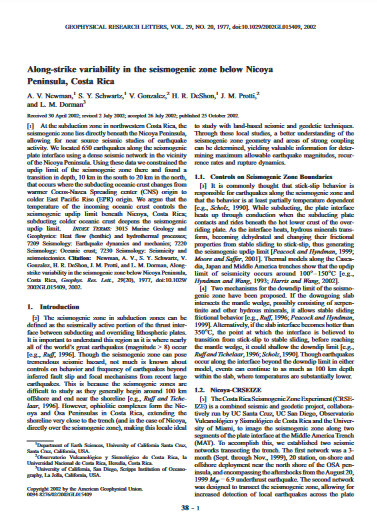
Along-strike variability in the seismogenic zone below Nicoya Peninsula, Costa Rica
(American Geophysical Union, 2002)
At the subduction zone in northwestern Costa Rica, the seismogenic zone lies directly beneath the Nicoya Peninsula, allowing for near source seismic studies of earthquake activity. We located 650 earthquakes along the ...

The March 25, 1990 (Mw=7.0, ML=6.8), earthquake at the entrance of the Nicoya Gulf, Costa Rica: Its prior activity, foreshocks, aftershocks, and triggered seismicity
(American Geophysical Union, 1995-10-10)
On March 25, 1990 a large earthquake (Mw = 7.0, ML = 6.8) occurred at the entrance of the Nicoya Gulf, Costa Rica, at 1322:55.6 UTC, producing considerable damage in central Costa Rica and generating much interest about ...
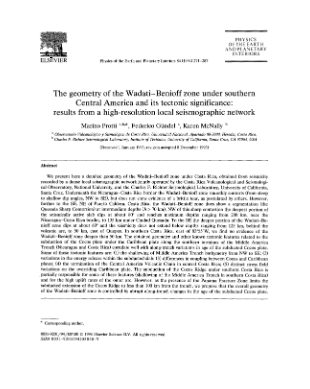
The geometry of the Wadati-Benioff zone under southern Central America and its tectonic significance: results from a high-resolution local seismographic network
(Elsevier, 1994)
We present here a detailed geometry of the Wadati—Benioff zone under Costa Rica, obtained from seismicity recorded by a dense local seismographic network jointly operated by the Costa Rica Volcanological and Seismological ...
Consideration of the seismic hazard on the land use planning of the Poas Canton, Costa Rica
(Boletin de Geologia, 2016-07-03)
To incorporate the seismic hazard assessment in the land use planning can be done using seismic methods and Geographic Information System (GIS), in order to avoid the use of simplifications provided in law. In this paper, ...
Deslizamientos cosísmicos Terremoto de Cinchona del 8 de enero de 2009
(Escuela de Ciencias Geográficas, 2012-01-11)
Delimitación de deslizamientos (activos, flujos y movimientos antrópicos) y ubicación del epicentro del terremoto de Cinchona, año 2009.
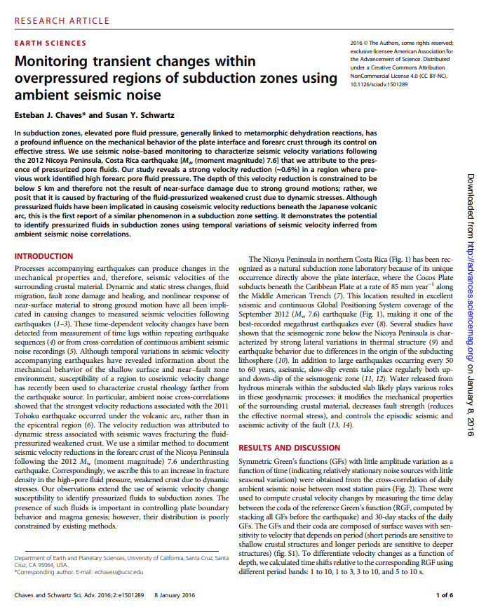
Monitoring transient changes within overpressured regions of subduction zones using ambient seismic noise
(American Association for the Advancement of Sciences (AAAS), 2016)
In subduction zones, elevated pore fluid pressure, generally linked to metamorphic dehydration reactions, has a profound influence on the mechanical behavior of the plate interface and forearc crust through its control on ...
Cantón 208: Poás Eventos Sísmicos
(Escuela de Ciencias Geográficas, 2008-02)
Eventos Sísmicos en el cantón de Poás.
OKSP: a novel deep learning automatic event detection pipeline for seismic monitoring in Costa Rica
(Instituto de Ingenieros Eléctricos y Electrónicos (IEEE), 2021)
Small magnitude earthquakes are the most abundant but the most difficult to locate robustly and well due to their low amplitudes and high frequencies usually obscured by heterogeneous noise sources. They highlight crucial ...